ShipView™ interface walkaround
Main user interface and Layers Panel
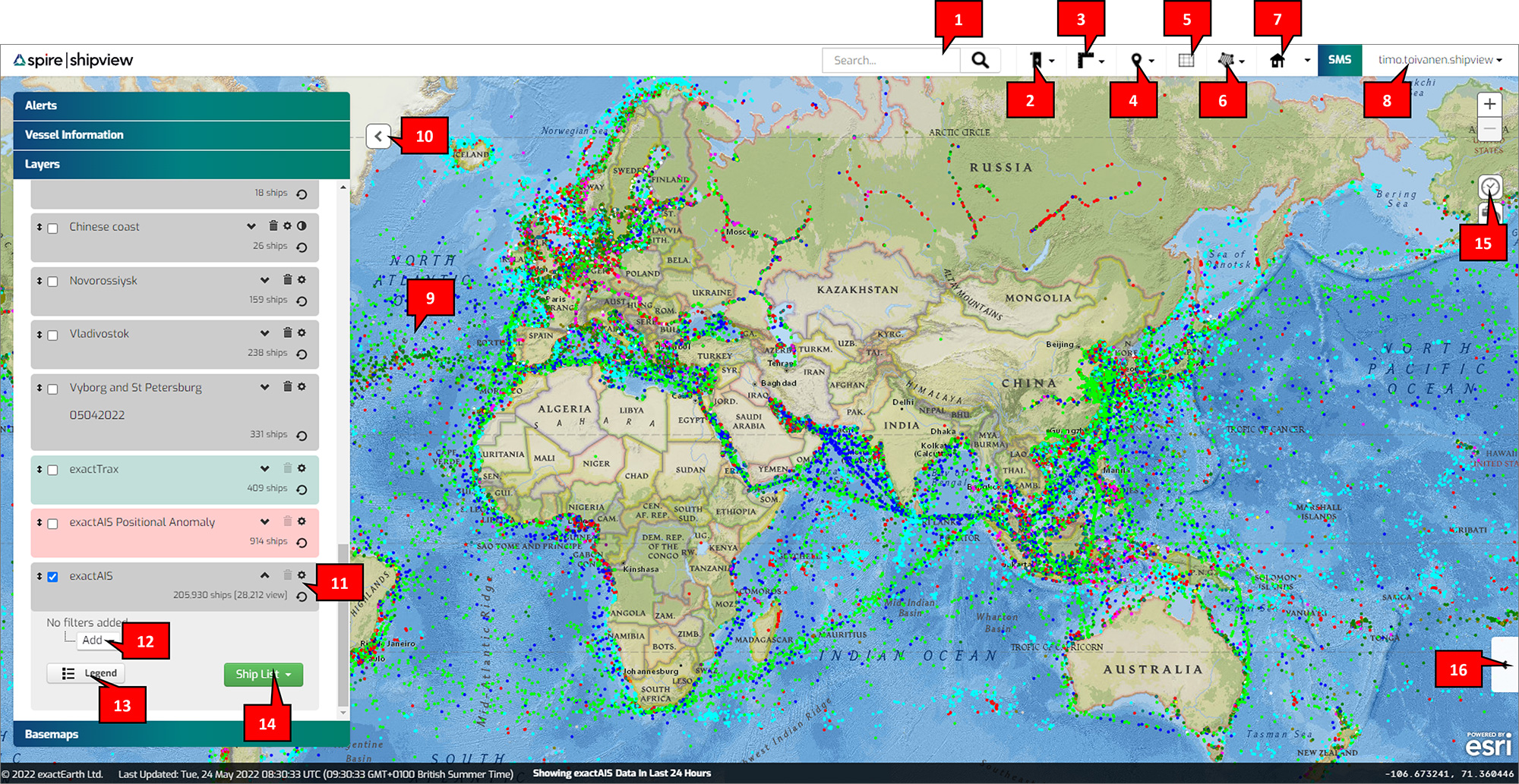
- Search: Search for ships by name, MMSI, IMO, Call Sign, Country, Destination, or Flag MID
- Bookmarks: Create bookmarks that zoom to map positions you frequently monitor
- Measure: Measure bearings, distances, areas, or circles in the unit of choice
- Gazetteer: Pre-defined common sea areas to quickly navigate the map
- Grid: Shows a graticule overlay on the map with major latitude and longitude lines
- Draw/Manage Polygon: Find ships by area, and create and manage areas of interest (polygons)
- Home View: Create a default view location
- Preferences: Apply settings such as measurement units and historical look back duration
- New Layers: Add a new layer using either exactEarth Ships, OGC WMS or Esri ArcGIS services
- Show/Hide Panel: Collapse or expand panel to maximise map view
- Layer Configuration: Shows ship counts and layer name and tools to edit and delete layers
- Rules and Groups: Add, edit, or delete rules and groups to filter ships by attributes
- Show/Hide Legend: Display legend for exactEarth Ships or any WMS map layers
- Ship List: View or Download ships by either “All Ships” or “Ships in View”
- Track Timeline: Alter exactEarth Ships track time ranges
- Track Playback Toolkit: Expand Track Playback Toolkit to enable step by step historical vessel track playback
Vessel Information Panel
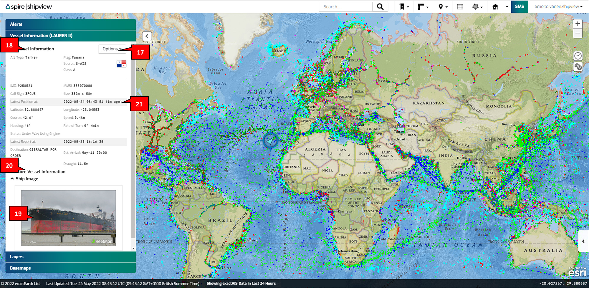
- Options: Clear the current ship from the map, download tracks or history, or create a new track layer
- Vessel Information: Shows all vessel information for the selected vessel from the map
- Ship Image: Where available, a ship image is displayed for the selected vessel, clicking on the image will enlarge the photo
- More Vessel Information: Shows additional vessel information, where available. E.g. Builder, Owner, Insurer, Year Built
- Age of Vessel Position: The relative age of the most recent position message (ranges from 1 second to 23 hours and 59 minutes, after which is >1 day)
Basemap Panel
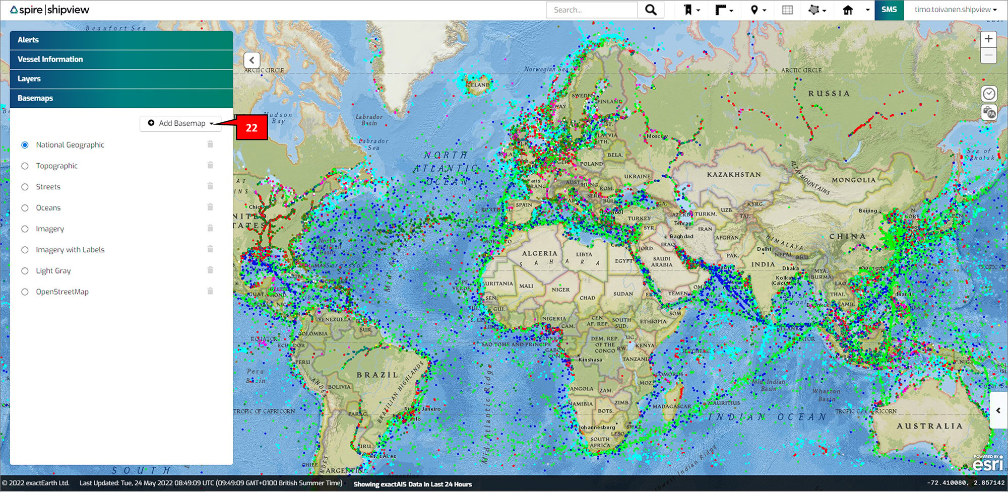
- Add Basemap: Add one of the pre-defined basemaps or add your own basemaps either OGC WMS, Tiled/XYZ, or Esri ArcGIS services.
Alerts Panel
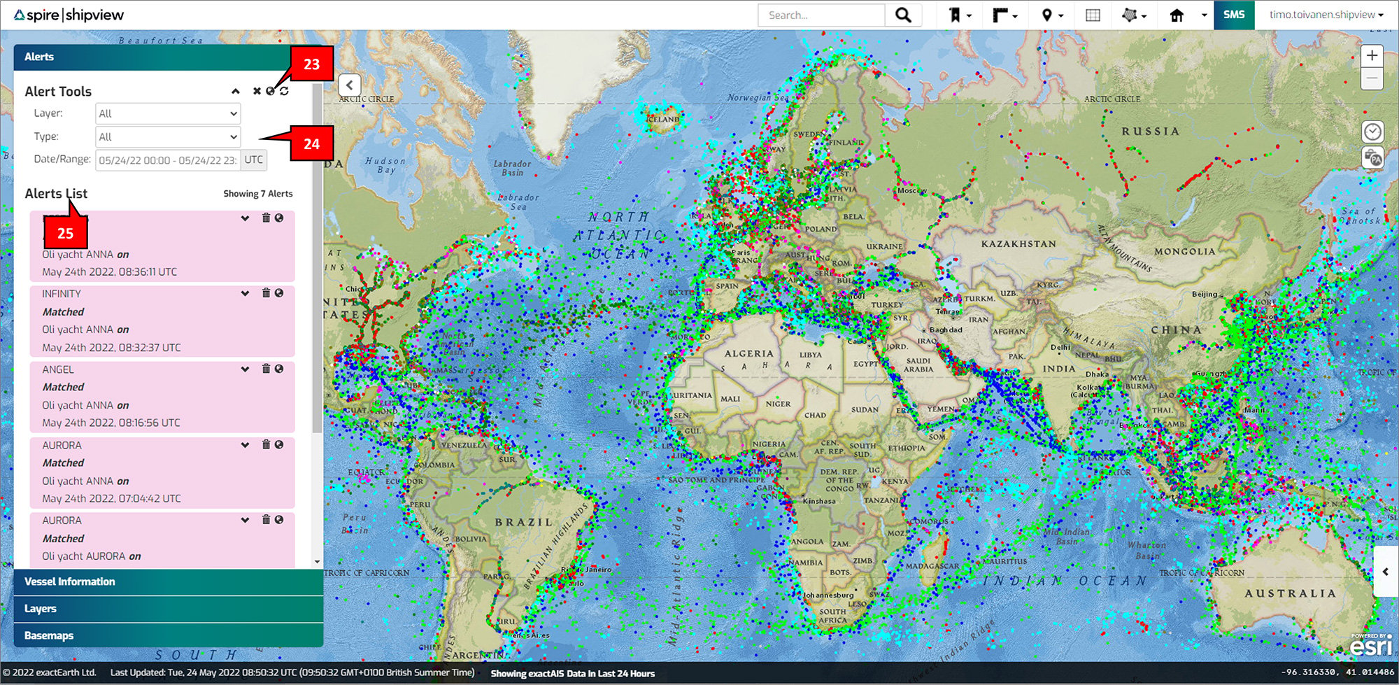
- Alert Tools: For subscribers, delete all currently displayed alerts, clear any on map alert icons, and refresh the alerts list
- Alert Rules/Filters: Add rules to filter alerts list including by layer, type, and date/range
- Alerts List: For subscribers, displays any available alerts based on the alert rules/filters